Global Tsunami risk modelling web service
The web service for the Global Tsunami Risk model provides access to the tsunami inundation hazard performed for the Global Risk Model carried out for UNDRR related to the 2015 Global Assessment Report (GAR15).
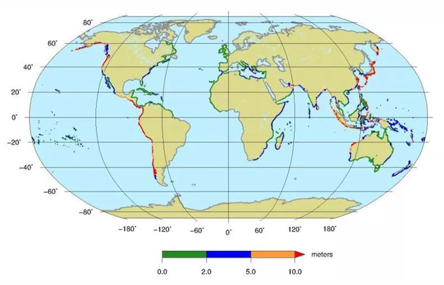
The methodology consists of a combination of probabilistic tsunami hazard assessment (PTHA) and GIS analysis for providing tsunami inundation maps (a static map of the 500-year return period global tsunami hazard data is shown in the figure below).
The data are provided for a return period of 500 years. The maps are projected on open-source topographic data. The PTHA analysis contains various steps, including simulations of thousands of scenarios, and is documented in the following references (links to these papers are given below):
- Løvholt et al., 2014; 2015
- Davies et al., 2018)
Tsunami exposure is calculated by combining a global population dataset (GRUMP) with STRM terrain model and projected tsunami inundation heights using global amplification factors.
This service is part of the candidate Thematic Core Service for tsunami and will be integrated into the Integrated Core Service Data Portal of the European Plate Observing System (EPOS).

Graphics showing the global tsunami hazard map
GIS modeling
The GIS calculation aimed to take the maximum inundation height points at points along the shoreline and produce hazard maps (which areas are wet). The results of these calculations are published as a Web Map Service (WMS) and a Web Coverage Service (WCS) service.
The WMS service is a map service ready for display in GIS applications supporting the WMS standard, while the WCS service is ready for downloading and processing data. See the specification for the service types at https://www.ogc.org/standards/wms and https://www.ogc.org/standards/wcs.
WMS service with GAR data:
WCS service with GAR data (GetCapabilities):
URL to use in ArcGIS and QGIS desktop:
Papers describing the methodology
- Løvholt et al., (2014), International Journal of Disaster Risk Reduction:
https://www.sciencedirect.com/science/article/pii/S2212420914000326 - Løvholt et al., (2015), Complexity in Tsunamis, Volcanoes, and their Hazards pp 213-246
- https://doi.org/10.1007/978-3-642-27737-5_642-1
- https://www.researchgate.net/publication/353908316_Tsunami_Hazard_and_Risk_Assessment_on_the_Global_Scale - Davies et al., (2018), Geological Society of London: https://sp.lyellcollection.org/content/456/1/219.short
- Terms and conditions for use are given by CC BY-ND 4.0:
https://creativecommons.org/licenses/by-nd/4.0/
